
New York State Flag |

New York State Seal |
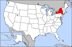
New York Location |
New York
New
York is a state in the northeastern United States whose U.S. postal
abbreviation is NY. It is sometimes called New
York State when there is need to distinguish it from New
York City. The areas of New
York State north of Westchester County are collectively referred
to as Upstate New York, though residents of New
York City consider Westchester County to be "upstate"
as well.
| Capital |
Albany |
|
| Largest
City |
New
York |
| Governor
(2005) |
George
Pataki (R) |
Area
- Total
- Land
- Water
- % water |
141,205 km² (27th)
122,409 km²
18,795 km²
13.3% |
Population
- Total (2000)
- Density |
19,190,115 (3rd)
155.18 /km² (6th) |
Admittance
into Union
- Date
- Order |
July 26, 1788
11th |
| Time
zone |
Eastern:
UTC-5/-4 |
Latitude
Longitude |
40°29'40"N
to 45°0'42"N
71°47'25"W to 79°45'54"W |
Width
Length
Elevation
- Highest
- Mean
- Lowest |
455
km
530 km
1,629 m
305 m
0 m |
| ISO
3166-2 |
US-NY
|
| Official languages |
None (English
is de facto) |
| State
nickname |
Empire
State |
| |
|
|
Geography
New York State's
borders touch (clockwise from the northwest) two Great Lakes (Erie and
Ontario, which are connected by the Niagara River), the provinces of
Ontario and Quebec
in Canada, three New England
states (Vermont, Massachusetts,
and Connecticut), the Atlantic
Ocean, and two Mid-Atlantic states (New
Jersey and Pennsylvania).
In addition, Rhode Island
shares a water border with New
York.
New
York is also the site of the only extra-territorial enclave within
the boundaries of the USA, the United Nations compound on Manhattan's
East River.
The southern tip
of New York State—New
York City, its suburbs, and the southern portion of the Hudson Valley—can
be considered to form the central core of a "megalopolis,"
a super-city stretching from the northern suburbs of Boston
to the southern suburbs of Washington
and therefore occasionally called "BosWash". First described
by Jean Gottmann in 1961 as a new phenomenon in the history of world
urbanization, the megalopolis is characterized by a coalescence of previous
already-large cities of the Eastern Seaboard, a heavy specialization
on tertiary activity related to government, trade, law, education, finance,
publishing and control of economic activity, plus a growth pattern not
so much of more population and more area as more intensive use of already
existing urbanized area and ever more sophisticated links from one specialty
to another. Several other groups of megalopolis-type super-cities exist
in the world, but that centered around New
York City was the first described and still is the best example.
 The
megalopolis, however, is not the only aspect of New
York State. While best known for New
York City's urban atmosphere, especially Manhattan's
skyscrapers, by contrast the rest of the state is dominated by farms,
forests, rivers, mountains, and lakes. Few people know that New York's
Adirondack State Park is larger than any National Park in the U.S. outside
of Alaska. Niagara Falls,
on the Niagara River as it flows from Lake Erie to Lake Ontario is a
popular attraction; the best view is from the Canadian side. The Hudson
River flows south through the eastern part of the state without draining
Lakes George or Champlain. Lake George empties at its north end into
Lake Champlain, whose northern end extends into Canada,
where it drains into the Richelieu and then the St Lawrence Rivers.
Four of New
York City's five boroughs are on the three islands at the mouth
of the Hudson River: Manhattan Island, Staten Island, and Long Island. The
megalopolis, however, is not the only aspect of New
York State. While best known for New
York City's urban atmosphere, especially Manhattan's
skyscrapers, by contrast the rest of the state is dominated by farms,
forests, rivers, mountains, and lakes. Few people know that New York's
Adirondack State Park is larger than any National Park in the U.S. outside
of Alaska. Niagara Falls,
on the Niagara River as it flows from Lake Erie to Lake Ontario is a
popular attraction; the best view is from the Canadian side. The Hudson
River flows south through the eastern part of the state without draining
Lakes George or Champlain. Lake George empties at its north end into
Lake Champlain, whose northern end extends into Canada,
where it drains into the Richelieu and then the St Lawrence Rivers.
Four of New
York City's five boroughs are on the three islands at the mouth
of the Hudson River: Manhattan Island, Staten Island, and Long Island.
The five New
York City boroughs (and their counties) are: (1) The Bronx
(Bronx), on the mainland, north of (2) Manhattan
(New York) on Manhattan Island. The Hudson River is their western boundary.
(3) Brooklyn (Kings) and (4) Queens
(Queens) are across the East River from Manhattan
on the western end of Long Island, and (5) Staten
Island (Richmond) is south of Manhattan. The eastern end of Long
Island includes suburban Nassau and Suffolk,
but Long Island is not one of the boroughs.
"Upstate"
is a common term for New York
State north of the New
York City metropolitan area; but many of those outside of the NYC
metropolitan area find the term demeaning because it is emblematic of
the cultural and demographic divide which separates the two areas, one
rural and conservative, the other urban and liberal. Which of the suburban
counties north of The Bronx along the Hudson River (Rockland,
Westchester,
and Putnam)
count as "Upstate" depends on who is making the list. Upstate
New York typically includes
the Catskill and Adirondack Mountains, the Shawangunk Ridge, the Finger
and Great Lakes in the west and Lake Champlain, Lake George, and Oneida
Lake in the northeast, and rivers such as the Delaware, Genesee, Hudson,
Mohawk, and Susquehanna. The highest elevation in New
York is Mount Marcy in the Adirondacks.
East of New
York City extends the appropriately named "Long Island,"
stretching approximately 120 miles (190 km) from Brooklyn and Queens
Counties (part of NY City) on the western
end to Orient and Montauk Points in the rural "East End" of
the Island. The two counties that are encountered as one travels east
from NY City are Nassau and Suffolk.
Three of Suffolk County's ten towns—Brookhaven,
Riverhead, and Southampton—are
host to the 102,500 acre (415 km²) State designated and protected
Central Pine Barrens region. This remarkably undeveloped region overlies
part of Long Island's federally designated Sole Source Aquifer which
provides drinking water to nearly three million residents, and it contains
terrestrial and aquatic ecosystems of statewide and national significance,
interconnected surface and ground waters, recreational areas, historic
locales, farmlands, and residential communities. This region is the
largest remnant of a forest thought to have once encompassed over a
quarter million acres (1,000 km²) on Long Island following the
last glacial advance some 15,000 to 20,000 years ago. Much of the region's
ecosystem is similar to the larger New Jersey Pinelands (also called
"pine barrens") to the south and southwest of NY
City, along with Cape Cod's pine barrens. All three areas share
geologic and ecological characteristics common along the Atlantic Coastal
Plain of the U.S.
Trees have played
a major role in the surrounding areas of New
York. Very large trees can even grow in the New York metropolitan
area (for example, the Queens Giant is the tallest tree in the NY metro
area and the oldest living thing in the NY metro area.)
History
The Dutch were the
first European settlers in the colony known as New Netherland (Nova
Belgica in Latin). Fort Nassau was founded near Albany,
New York in 1614 and abandoned in 1618. About thirty Walloon families
settled on the shores of the Hudson River near what is present day New
York City and on the Delaware River around 1624. The Dutch also
established Fort Oranje near present-day Albany
in 1624. New Amsterdam was established on the island of Manhattan a
year later by Peter Minuit. After the English took over in 1664, the
colony was renamed New York,
after the Duke of York, the future King James II of England.
On November 1, 1683,
the government was reorganized into a pattern still followed, and the
state was divided into twelve counties, each of which was subdivided
into towns. Ten of those counties still exist (see below), but two (Cornwall
and Dukes) were in territory purchased by the Duke of York from the
Earl of Sterling, and are no longer within the territory of the State
of New York, having been transferred by treaty to Massachusetts,
Dukes in 1686 and Cornwall in 1692. (Cornwall County became a large
portion of the State of Maine
when that state was detached from Massachusetts
in 1819; Dukes County is still a county in Massachusetts.)
While the number of counties has been increased to 62, the pattern still
remains that a town in New York
State is a subdivision of a county, rather than an incorporated
municipality as in most (but not all) other States.
New
York was one of the thirteen colonies that revolted against British
rule in the American Revolution.
Upstate New York
Upstate New
York (as well as parts of present Ontario,
Quebec, Pennsylvania,
and Ohio) was occupied by
the Five Nations (after 1720 becoming Six Nations, when joined by Tuscarora)
of the Iroquois Confederacy for at least a half millennium before the
Europeans came. At the onset of the Revolutionary War, there lay a vast
tract of land from the upper Mohawk River to Lake Erie, that was thinly
occupied by the Iroquois and virtually unknown to the colonists. Since
the colonial charters of both Massachusetts
and New York granted unlimited
westward expansion, the claim to this tract was disputed. There were
also many tensions between the original Dutch settlers in the Hudson
and Mohawk Valleys and the English who were rapidly arriving in Eastern
New York, and the Germans
who were also establishing settlements in the Mohawk area.
Upstate New
York was also the scene of fighting during the French and Indian
War, with British and French forces contesting control of Lake Champlain
in association with Native American allies.
During the period
prior to the American Revolution, a territorial dispute developed between
New York and the Republic
of Vermont that continued until after the war. Ultimately, the colonial
counties of Cumberland and Gloucester were lost from New
York after 1777.
The Revolution began with
the Six Nations officially neutral, but this quickly broke down as British
and Tory agents courted them on the one hand, and the American rebels
on the other. In fact the Revolution effectively broke the Iroquois
confederacy forever, with the Oneida Nation and Tuscarora Nations supporting
the American side, and the Mohawk Nation, Onondaga Nation, Cayuga Nation
and Seneca Nations going with the British and Tories. It was a strategic
error for the latter four nations, as they picked the eventual loser
in the Revolution.
The Iroquois were
thus a serious problem to the Americans fighting for independence. In
July of 1778 a force of perhaps one thousand Iroquois and Tories led
by the Tory Colonel John Butler and the Seneca war chief Cornplanter
overwhelmed a few hundred Americans in the Wyoming Valley (along the
Susquehanna River near present Wilkes-Barre,
Pennsylvania), which came to be known as the Wyoming Valley Massacre.
Whether or not a massacre took place in the Wyoming Valley is a matter
of historical debate. However, a massacre occurred at Cherry Valley
in November, when about 33 civilians (including women and children)
were murdered and scalped by the Iroquois who accompanied a British
and Tory raid.
As the Americans
gained control of more and more of Eastern New
York in 1779, Congress decided to end the Iroquois threat and General
George Washington sent Major General John Sullivan in June northward
from Wilkes-Barre.
Sullivan's troops only had one serious engagement at Newtown near present
day Elmira,
where they decisively routed a force led by Colonel Butler and the Mohawk
captain Joseph Brant.
The Sullivan Expedition moved
northward through the Finger Lakes and Genesee Country with a "scorched
earth" policy. All Iroquois communities were burned, their crops
destroyed, and their orchards hewn down. They found an incredibly beautiful
territory. The area between Seneca and Cayuga Lakes was maintained by
annual burning as a grassland prairie, and it abounded in wild game
including grazing American Bison herds. Orchards contained apples and
peaches. There were fields of corn and gardens with potatoes, turnips,
onions, pumpkins, squashes and vegetables of various kinds. The Iroquois
did not live in simple hovels as expected, but had handsome multi-family
houses, often called castles. The community of Seneca Castle is derived
from one such Iroquois village. Fish were abundant, and the natives
also had herds of milk cows and hogs for meat. They were amazingly prosperous.
As Sullivan's army
devastated the Iroquois homeland, refugees were forced to flee to Fort
Niagara, where they spent the following winter in hunger and misery,
sustained by gifts of salted meat given to them by British at the fort
community. Hundreds died of exposure, hunger and disease.
Sullivan's men returned
from the campaign to Pennsylvania
and New England to tell of the enormous wealth of this new territory.
Some carried huge ears of corn in their knapsacks as proof of the fertility
of the land. Many of them returned to land grants later in western New
York, given by the government in gratitude for their service in
the Revolution.
Opening Western New York
Following the American
Revolution, western New York
was opened up for American development as soon as New
York and Massachusetts
compromised and settled their competing claims for the area in December
1786 by the Treaty of Hartford. The compromise was that, while New
York would have sovereignty over the land, Massachusetts
would have the "preemptive" right to obtain title from the
Indians.
Following this treaty,
there were various groups attempting to circumvent the treaty and directly
obtain title from the Indians. For example, in 1787 John Livingston,
Col. John Butler, Samuel Street, a Capt. Powell, and Lt. William Johnston
attempted to circumvent the Treaty of Hartford by purporting to purchase
a 999-year lease of about 8 million acres (32,000 sq.km) from the Iroquois.
This lease, however, was promptly declared void by both the New
York and the Massachusetts
legislatures.
On April 1, 1788,
the entire Massachusetts preemptive right -- comprising
some 6,000,000 acres (24,000 km²) -- was sold to Oliver Phelps
and Nathaniel Gorham, both of Massachusetts. The
sales price was $1,000,000, payable in three equal annual installments
of certain Massachusetts securities then worth about
20 cents on the dollar. This sale was of the preemptive right for all
land west of a line running from the mouth of Sodus Bay on Lake Ontario,
due south to the 82nd milestone on the Pennsylvania
border near Big Flats (the "Preemption
Line") all the way to the Niagara River and Lake Erie. Phelps and
Gorham would not, however, own the land outright until they extinguished
all Indian titles.
Phelps and Gorham wasted
no time in treating with the Indian tribes. On July 8, 1788, by the
Treaty of Buffalo Creek, they extinguished Indian title to all land
from the Preemption Line west to the Genesee River, as well as to lands
west of the Genesee running south from Lake Ontario approximately 24
miles and extending west from the river 12 miles from "the westernmost
bend of the Genesee," with this western boundary paralleling the
course of the Genesee. This 184,300 acre (746 km²) tract west of
the Genesee was known as The Mill Yard Tract, so named because Phelps
and Gorham asked the Indians for land west of the Genesee at the Upper
Falls so they could build a sawmill and gristmill. For this extinction
of title, Phelps and Gorham paid the Indians $5,000, plus an annuity
of $500. The area to which title was extinguished comprised some 2,250,000
acres (9,100 km²), including the Mill Yard Tract.
Phelps and Gorham,
however, ran into financial difficulties, and after making the first
installment payment in 1789, they defaulted in 1790. After extensive
negotiation, proposals and counter-proposals, all parties agreed that
the preemptive right to lands of the Phelps and Gorham Purchase west
of the Genesee River, comprising some 3,750,000 acres (15,200 km²),
would revert back to Massachusetts, which occurred
on March 10, 1791. On March 12, 1791, Massachusetts
agreed to sell its reverted preemptive right to lands west of the Genesee
to Robert Morris for $333,333,33. The land was conveyed to Morris in
five deeds on May 11, 1791. At that time, Morris was the richest man
in America, as well as a signer of the Declaration of Independence,
and a financier of the American Revolution.
Morris then re-sold
most of these lands in December 1792 and in February and July 1793 to
the Holland Land Company (known as The Holland Purchase). Morris was
obligated, however, to extinguish Indian title to these lands before
the sale would be final and he would be paid in full. In September 1797,
Morris extinguished the remaining Indian title for all the lands west
of the Genesee at the "Treaty of Big Tree" (Geneseo). The
Holland Land Company opened a land sales office in Batavia
in 1802, and sales of the tract commenced. The phrase "doing a
land office business," which denotes prosperity, dates from this
era. The land office still exists and is a museum today.
The Holland Land Co. office in Batavia, New York,
now a museum.Morris did not convey to the Holland Land Company all of
the lands he received from Massachusetts. He reserved
for himself 500,000 acres (2,000 km²) in a strip twelve miles wide
along the east side of the lands acquired from Massachusetts.
The strip ran from the Pennsylvania border to Lake
Ontario, and was known as The Morris Reserve. At the north end of the
Morris Reserve, a 87,000 acre (350 km²) triangular shaped tract
("The Triangle Tract") was sold by Morris to Herman Leroy,
William Bayard and John McEvers, while a 100,000 acre (400 km²)
tract due west of the Triangle Tract was sold to the State
of Connecticut.
The Phelps and Gorham lands
east of the Genesee River that had not already been sold were also acquired
by Robert Morris in August 1790 -- some 1,200,000 acres (4,900 km²)
-- who re-sold them to the Pulteney Association.
Some purchases of
Iroquois lands, especially those negotiated by agents representing the
State of New York after
1795, are the subject of numerous modern-day land claims by the individual
nations of the Six Nations. These lawsuits are predicated on the argument
that the 1794 federal Treaty of Canandaigua and the 1790 Trade and Intercourse
Act forbade the state of New
York from conducting land transactions with Indian nations.
Settlement of Northern New
York
Macomb's
Purchase: Laid out ten townships in 1791 of a purchase by Alexander
Macomb from the state. One row of 5 townships along the St. Lawrence
River, the second row back from that, included a large segment of northern
NY.
Settlement of the Catskills
The development
of the Catskills was delayed due to conflicting land claims and lack
of surveys. Much of the higher land was never settled and cleared and
is today part of the Catskill Mountain Forest Preserve.
The Erie Canal
Since navigation
was primarily by water, there were limitations on the settlement of
western New York. One could
navigate up the Hudson and Mohawk Rivers to Central New
York, but then had to pass overland to reach the west. Likewise
one could come up the St. Lawrence River to Lake Ontario but had to
move overland from its southern shore, and the way westward to the remaining
Great Lakes was also blocked by Niagara Falls. From 1807 there was discussion
of a canal, or series of canals, all of which came to naught, until
Governor DeWitt Clinton put all his weight into the proposal, and in
1817 the first portion of a canal was begun, to connect the Hudson River
with Lake Erie (and thence to the rest of the Great Lakes). The easy
part was built first, a series of bypasses of rapids on the Mohawk River.
Though there was
opposition, and the canal was derisively called "Clinton's Ditch"
or worse, "Clinton's Folly," the canal was finally completed
in 1825. Officially the event was celebrated by cannon shots along the
length, and by Governor Clinton ceremonially pouring Lake Erie water
into the New York Harbor in the "Wedding of the Waters." The
Erie Canal proved to be a stroke of genius, as settlers now poured from
New England, Eastern New York
and Europe into the central and western part of the state. Others went
on to Ohio and Michigan.
The Canal was the first serious route for settlement west of the Appalachian
Mountains, which had previously been a geographic barrier. Now upstate
farms and industries could easily ship their products to the large and
growing market of New
York City and beyond. Had the Welland Canal, which bypassed Niagara
Falls to connect Lakes Ontario and Erie, been built first, instead of
in 1833, the history of North America could have been far different,
with Montreal,
Quebec becoming the main eastern port, instead of New
York City.
The Erie Canal,
though no longer so important a trade route (it is supplanted by railroads
and highways) still defines the central commerce belt of New
York State. The port city of Buffalo,
Lockport,
where the canal crossed a great limestone ridge, mill-town Rochester
on the Genessee, and many smaller cities owe their growth, perhaps even
their existence, to the Erie. Connecting canals were also built to Lake
Ontario and the larger Finger Lakes.
Law and Government
As in all fifty states, the
head of the executive branch of government is a Governor. The legislative
branch is called the Legislature and consists of a Senate and an Assembly.
Unlike most States, the New York electoral law permits electoral fusion,
and New York ballots tend to have, in consequence, a larger number of
parties on them, some being permanent minor parties that seek to influence
the major parties and others being ephemeral parties formed to give
major-party candidates an additional line on the ballot.
New York's legislature is
notoriously dysfunctional. The Assembly has long been controlled by
the Democrats, the Senate has long been controlled by the Republicans,
and there is little change in membership election to election. From
1984 through 2004, no budget was passed on time, and for many years
the legislature was unable to pass legislation for which there was supposed
to be a consensus, such as reforming the so-called Rockefeller drug
laws.
In presidential
elections, New York tends
to support Democratic candidates and has done so consistently beginning
in 1988, mainly because of the weight of New
York City, a Democratic and Liberal stronghold. In 2004, New
York gave John Kerry a comfortable margin of 18 percentage points
and 58.4% of the vote. Many counties of Upstate New
York, especially in rural areas, voted for the Republican candidate.
However, this is with the notable exception of those Upstate counties
with large cities, such as Erie County (Buffalo),
Monroe County (Rochester),
Onondaga County (Syracuse),
Tompkins County (Ithaca),
and Albany County (Albany),
as well as several others which voted blue in 2004.
In 2002, 16,892
bills were introduced in the New York legislature, more than twice as
many as in the Illinois General Assembly, whose
members are the second most prolific. Of those bills, only 4 percent,
693, actually became law, the lowest passing percentage in the country.
In 2004 over 17,000 bills were introduced.
New York's legislature
also has more paid staff, 3,428 than any other legislature in the nation.
Pennsylvania, whose staff is the second largest,
only had 2,947, and California only 2,359. New York's
legislature also has more committees than any other legislature in the
nation.
New York's subordinate political
units are its 62 counties. Other officially incorporated governmental
units are towns, cities, and villages.
For decades it has
been the established practice for Albany
to pass legislation for some meritorious project, but then mandate county
and municipal government to actually pay for it. New
York State has its counties pay a higher percentage of welfare costs
than any other state and New
York State is the only state which requires counties to pay a portion
of Medicaid.
The court system
in New York is notable for
its "backwards" naming: the state's trial court is called
the New York Supreme Court, while the highest court in the state is
the New York Court of Appeals.
Economics
New
York City dominates the economy of the state. It is the leading
center of banking, finance and communication in the United States and
is the location of the New York Stock Exchange (NYSE) on Wall Street,
Manhattan. The Bureau of Economic Analysis
estimates that in 2003, the total gross state product was $822 billion,
second only to California. Its 2003 Per Capita Personal
Income was $36,112, placing it 6th in the nation. New York's agricultural
outputs are dairy products, cattle and other livestock, vegetables,
nursery stock, and apples. Its industrial outputs are printing and publishing,
scientific instruments, electric equipment, machinery, chemical products,
and tourism.
 New
York is best known for its tertiary sector specializing in foreign
trade, together with banking, port facilities, advertising, warehousing,
and other activities needed to support large-scale commerce. In addition,
many of the world's largest corporations locate their headquarters home
offices in Manhattan
or in nearby Westchester County, New
York. The state also has a large manufacturing sector which includes
printing, garments, furs, railroad rolling stock, and bus line vehicles.
Some industries are concentrated in upstate locations also, such as
ceramics (the southern tier of counties) and photographic equipment
(Rochester). New
York is best known for its tertiary sector specializing in foreign
trade, together with banking, port facilities, advertising, warehousing,
and other activities needed to support large-scale commerce. In addition,
many of the world's largest corporations locate their headquarters home
offices in Manhattan
or in nearby Westchester County, New
York. The state also has a large manufacturing sector which includes
printing, garments, furs, railroad rolling stock, and bus line vehicles.
Some industries are concentrated in upstate locations also, such as
ceramics (the southern tier of counties) and photographic equipment
(Rochester).
There is a moderately
large saltwater commercial fishery located along the Atlantic side of
Long Island. The principal catches by value are clams, lobsters, squid,
and flounder. There used to be a large oyster fishery in New
York waters as well, but at present, oysters comprise only a small
portion of the total value of seafood harvested. Perhaps the best known
aspect of the fishing sector is the famous Fulton Fish Market in New
York City, which distributes not only the New
York catch, but imported seafood from all over the world. The famous
Fulton Fish Market has been moved to the Bronx.
New York's mining sector, which is larger than most people think, is
concentrated in three areas. The first is near New
York City. Primarily, this area specializes in construction materials
for the many projects in the city, but its also contains the emery mines
of Westchester County, one of two locations in the USA where that mineral
is extracted. The second area is the Adirondack Mountains. This is an
area of very specialized products, including talc, industrial garnets,
and zinc. It should be noted that the Adirondacks are not part of the
Appalachian system, despite their location, but are structurally part
of the mineral-rich Canadian Shield. Finally in the inland southwestern
part of the state in the Allegheny Plateau is a region of drilled wells.
The only major liquid output at present is salt in the form of brine;
however, there are also small to moderate petroleum reserves in this
area.
Agriculture
 New
York State is an agricultural leader, ranking within the top five
states for a number of products including dairy, apples, cherries, cabbage,
potatoes, onions, maple syrup and many other products. The state has
about a quarter of its land in farms and produced 3.4 billion dollars
in agricultural products in 2001. The south shore of Lake Ontario provides
the right mix of soils and microclimate for many apple, cherry, plum,
pear and peach orchards. Apples are also grown in the Hudson Valley
and near Lake Champlain. The south shore of Lake Erie and the southern
Finger Lakes hillsides have many vineyards. New
York State is the nation's third-largest wine-producing state, behind
California and Washington
State. New
York State is an agricultural leader, ranking within the top five
states for a number of products including dairy, apples, cherries, cabbage,
potatoes, onions, maple syrup and many other products. The state has
about a quarter of its land in farms and produced 3.4 billion dollars
in agricultural products in 2001. The south shore of Lake Ontario provides
the right mix of soils and microclimate for many apple, cherry, plum,
pear and peach orchards. Apples are also grown in the Hudson Valley
and near Lake Champlain. The south shore of Lake Erie and the southern
Finger Lakes hillsides have many vineyards. New
York State is the nation's third-largest wine-producing state, behind
California and Washington
State.
New York was heavily glaciated
in the ice age leaving much of the state with deep, fertile, though
somewhat rocky soils. Row crops, including hay, corn, wheat, oats, barley,
and soybeans, are grown. Particularly in the western part of the state,
sweet corn, peas, carrots, squash, cucumbers and other vegetables are
grown. The Hudson and Mohawk valleys are known for pumpkins and blueberries.
The glaciers also left numerous swampy areas, which have been drained
for the rich humus soils called muckland which is mostly used for onions,
potatoes, celery and other vegetables. Dairy farms are present throughout
much of the state. Cheese is a major product, often produced by Amish
or Mennonite farm cheeseries. New
York is rich in nectar-producing plants and is a major honey-producing
state. The honeybees are also used for pollination of fruits and vegetables.
Most commercial beekeepers are migratory, taking their hives to southern
states for the winter. Most cities have Farmers' markets which are well
supplied by local truck farmers.
Demographics
|
According to the U.S. Census Bureau, as of 2004,
New
York was the third largest state in
population after California
and Texas, with a
population of 19,227,088, a 0.2% increase over the 2003 population
(19,190,115).
According
to 2003 estimate, 20.4% of the population was foreign-born. The
racial makeup of the state was:
62.0% White,
not of Hispanic origin
15.9% Black
15.1% Hispanic
5.5% Asian
0.4% Native American
3.1% mixed race
The top 5 ancestry groups in New
York are African American (15.9%), Italian (14.4%), Irish
(12.9%), and German (11.2%).
New
York contains the nation's largest Dominican population (concentrated
in Upper Manhattan)
and largest Puerto Rican population (concentrated in the Bronx).
Brooklyn
and the Bronx
are home to many blacks and Queens
has a large population of Latin American origin, as well as the
state's largest Asian population.
The 2000 Census
revealed which ancestries were in which counties. Italian-Americans
make up the largest ancestral group in Staten
Island and Long Island, followed by Irish-Americans. Manhattan's
leading ancestry group is Irish-Americans, followed by Italian-Americans.
Albany
and southeast-central New
York are heavily Irish-American. In Buffalo
and western New York,
German-Americans are the largest group; in the northern tip of
the state, French-Canadians.
6.5% of New
York's population were reported as under 5 years of age, 24.7%
under 18, and 12.9% were 65 or older. Females made up approximately
51.8% of the population.
The bulk of
New York's population lives within two hours of the city. According
to the July 1, 2004 Census Bureau Estimate, New
York City and its six closest New
York State satellite counties (Suffolk, Nassau, Westchester,
Rockland, Putnam and Orange) have a combined population of 12,626,200
people, or 65.67% of the state's population.
Religion
In 2001,
the five largest denominations in New
York were: Roman Catholic (about 38% of total state population),
Baptist (7%), Methodist (6%), Jewish (5%) and Lutheran (3%).
New
York is home to more of America's Jews (25% of their national
total), Muslims (24%), Taoists (26%), and Greek Orthodox (17%)
than any other state.
The Washington
Heights neighborhood of Manhattan
contains the shrine and burial place of Saint Frances Xavier Cabrini
(Mother Cabrini), the patron saint of immigrants and the first
American citizen to be canonized.
At Chautauqua
Lake in the southwestern portion of the state is the Chautauqua
Institution, co-founded by Methodist Rev. John Vincent and devoted
to adult continuing education in a uplifting setting, as that
ambiance was understood in the last half of the Nineteenth Century.
The Institution, which still exists, offers to a predominately
middle class and Mid-American clientele a very high standard of
intellectual summer lectures, mixed with certain elements of folksy
relgious camp meetings, such as outdoor recreation and musical
events. While some aspects of this pedagogy may seem quaint today,
the Institution helped assure that high intellectual achievement
would be recognized as consistent with the value system of an
emerging powerful Midwest, and was one of several ways that Upstate
New York served between
the Civil War and World War II as a transmitting intermediary
between the standards of the East Coast and the interior agricultural
regions of the central states.
|
| Historical
populations |
Census
year |
Population
|
1790 |
340,120 |
1800 |
589,051
|
1810 |
959,049
|
1820 |
1,372,812 |
1830 |
1,918,608
|
1840 |
2,428,921
|
1850 |
3,097,394 |
1860 |
3,880,735 |
1870 |
4,382,759 |
1880 |
5,082,871
|
1890 |
6,003,174
|
1900 |
7,268,894
|
1910 |
9,113,614
|
1920 |
10,385,227
|
1930 |
12,588,066
|
1940 |
13,479,142 |
1950 |
14,830,192 |
1960 |
16,782,304 |
1970 |
18,236,967
|
1980 |
17,558,072
|
1990 |
17,990,455 |
2000 |
18,976,457 |
|
Important Cities and Towns
 Albany
is the state capital, and New York City
is the largest city. Albany
is the state capital, and New York City
is the largest city.
Its major cities
and towns are:
New
York City
Buffalo
Rochester
Yonkers
Syracuse
Albany
Niagara Falls
White Plains
New Rochelle
Mount Vernon
Schenectady
Utica
Binghamton
Ithaca
Troy
Bronx
Colleges and Universities
Besides the many
private colleges and universities in the state, New
York, like many other states, operates its own system of institutions
of higher learning known as the State University of New York System
(SUNY). New
York City operates the City University of New York (CUNY) in conjunction
with the state.
New York's public
land grant (agriculture) and forestry colleges are at private schools:
Cornell and Syracuse Universities, respectively.
Primary
and Secondary Education
The New York State Board of Regents, the University of the State of
New York and the State Education Department control all public primary
and secondary education in the state.
Professional Sports Teams
- National
Football League
- Buffalo
Bills
- The
following teams play in East
Rutherford, New Jersey, but are usually considered New
York teams
-
New York Jets
-
New York Giants
- New York
Knicks, National Basketball Association
- New York
Liberty, Women's National Basketball Association
- New York
Power, Women's United Soccer Association
- National
Hockey League
- Buffalo
Sabres
- New
York Rangers
- New
York Islanders
- Major
League Baseball
- New
York Mets
- New
York Yankees
- American
Hockey League
- Albany
River Rats
- Binghamton
Senators
- Rochester
Americans
- Syracuse
Crunch
- Major
League Lacrosse
- Long
Island Lizards
- Rochester
Rattlers
|
- Minor League
Baseball teams
- Brooklyn
Cyclones
- Staten
Island Yankees
- Binghamton
Mets
- Buffalo
Bisons
- Jamestown
Jammers
- Batavia
Muckdogs
- Rochester
Red Wings
- Auburn
Doubledays
- Syracuse
SkyChiefs
- Oneonta
Tigers
- Tri-City
Valley Cats (Troy)
- Hudson
Valley Renegades (Wappingers
Falls)
- Long
Island Ducks
- Major
League Soccer
- USL First
Division
- Arena
Football League
- National
Lacrosse League
- Buffalo
Bandits
- Rochester
Knighthawks
|
Miscellaneous
USS New York was named in
honor of this state.
The state animal: Beaver (Castor canadensis)
The state bird: Eastern Bluebird, (Sialia sialis).
The state song: I Love New York.
The state flower: Rose.
The state tree: Sugar maple (Acer saccharum).
The state fruit: Apple.
The state gemstone: Garnet.
The state motto: Excelsior (ever upward).
Frank's Hot Sauce is the official condiment of New
York State.
The
above article in gray is licensed under the
It
uses material from the
|


